


Maps: X Marks the Spot
地图:做个X标记
A new exhibition in London looks at the 20th century through its maps
伦敦的一个新展览透过地图回首20世纪
Modern cartography began to emerge in the 16th century as an instrument of power for rulers. But it was in the 20th century, with all its wars, revolutions, upheavals and helter-skelter technological change, that maps became truly democratised. In rich countries, near-universal education and the teaching of geography in schools ensured that most people could make sense of them. World wars required maps to be produced by the million. Meanwhile in civilian life the spread of the motor car, along with growing affluence that allowed more people to travel, expanded the private market. Mapmaking technology developed by leaps and bounds, progressing from land-based surveys to aerial photography to the Global Positioning System (GPS).
现代制图学始于16世纪,彼时是作为统治者的一种权力工具而存在。尽管20世纪有战争、革命、动荡和仓促的技术变革,但正是这个时候,地图真正开始为大众所用。在富裕国家,全民教育几近普及而且学校里教授地理课,这确保了大多数人都能看懂地图。两次世界大战期间需要制作出数以百万计的地图。同时在平民生活中,汽车的普及和财富的增加让更多人可以旅行,扩大了私人市场。制图技术也突飞猛进,从陆地测量发展到了航空摄影和全球定位系统(GPS)。
A new exhibition, “Maps and the 20th Century: Drawing the Line”, at the British Library (BL) in London until next March, examines the history of the past 100 years through maps. It considers their role in war and peace as well as in everyday life, their economic impact and, particularly towards the end of the period covered, their increasingly dynamic quality. Many of the 200 on show are drawn from the BL’s own remarkable collection of 4m maps.
从现在到明年3月,名为“地图与20世纪:划分界线”(Maps and the 20th Century: Drawing the Line)的新展览将在伦敦大英图书馆举办,透过地图来审视过去100年的历史。该展览考量了地图在战争与和平时期的作用、在日常生活中的角色、其经济影响(特别是在上世纪末的影响)以及地图越来越高的动态质量。参展的200幅地图中,许多都出自大英图书馆本身令人瞩目的400万幅地图藏品。
The exhibits are strikingly varied: detailed first-world-war trench maps (with annotations like “badly shelled” and “full of dead”); second-world-war silk escape maps made into a dress; an early sketch for Harry Beck’s famous map of the London underground that was eventually published in 1933; a fascinating map of the Atlantic Ocean floor, based on research commissioned by the American navy to identify hiding places for its nuclear submarines; and the awe-inspiring photograph of Earth taken during the Apollo Moon mission in 1968.
展品种类之多令人咋舌:详细的一战战壕地图(带有“遭猛烈炮轰”和“到处都是死人”等注解);制成连衣裙的丝质二战逃生地图;哈利·贝克(Harry Beck)那幅著名的、最终于1933年出版的伦敦地铁早期草图;美国海军为确定其核潜艇的隐藏地点,曾委托他人研究过大西洋海底,据此制作的一幅引人入胜的地图此次也被展出;此外还有1968年阿波罗登月任务期间拍摄的令人惊叹的地球照片。
Maps have always had to be useful, and most people think of them as objective representations of reality. But “maps are not innocent bystanders,” says Tom Harper, lead curator of the exhibition. “They help shape people’s perceptions.”
地图总得有用,而且大多数人认为它们是现实的客观体现。但“地图不是无辜的旁观者”,展览的主要策划者汤姆·哈伯(Tom Harper)说,“它们有助于塑造人们的观念。”
That starts with technical points such as the projections that turn a three-dimensional world into a two-dimensional map. Most world maps (including Google’s) use a variant of a projection invented in 1569 by a Flemish mapmaker, Gerardus Mercator, which was handy for navigation but exaggerates the apparent size of the temperate zone where most rich countries are concentrated. An alternative projection now called Gall-Peters, which properly reflects the relative size of continents, was promoted in the 1970s but did not catch on widely.
这开始于技术要点,例如将三维世界变成二维地图的投影法。大多数的世界地图(包括谷歌地图)都采用佛兰德制图师赫拉尔杜斯·墨卡托(Gerardus Mercator)于1569年发明的投影法的一种变式。这种方法便于航行,但夸大了大多数发达国家所在的温带地区的表观尺寸。另一种方法现在被称为高尔-彼得斯投影,它能正确反映出大陆的相对大小,在20世纪70年代得到推广,但并未广泛流行。
Maps are also used as propaganda tools, distorting certain features or pushing particular messages. The exhibition offers many examples, including motivational second-world-war maps, Vietnam-war-era protest maps and depictions of environmental pollution and tax havens.
地图也被用作宣传工具,会扭曲某些特点或者宣传特定的信息。展览提供了许多例子,包括激励士气的二战地图、越南战争时期的抗议地图以及展示环境污染和避税天堂的地图。
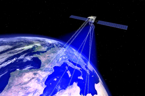
In the past few decades the digital revolution has utterly transformed mapmaking. Instead of being frozen in time, maps can now capture and reflect the constant change taking place in the real world. Thanks to Google Earth, every smartphone owner has the world at his fingertips, and will automatically find himself at the centre of it. The GPS system will make sure he never (well, hardly ever) gets lost.
在过去几十年里,数字革命已经彻底改变了地图的制作。如今地图不再被冻结在时间里,而是可以捕捉和反映现实世界中不断的变化。由于有了谷歌地球,对于每位智能手机用户而言,世界都随手可及,而且能自动把自己置于世界中心。GPS将会让人们不再(嗯,几乎不再)迷路。
Mr Harper thinks the next big thing in maps will be virtual reality. But despite all this extraordinary technological change, he reckons there will always be a space for traditional mapmaking techniques.
哈伯认为,地图界的下一件大事将会是虚拟现实。尽管有这样非凡的技术变革,但他认为传统制图技术还是会占有一席之地。
英文、中文版本下载:http://www.yingyushijie.com/shop/source/detail/id/436.html